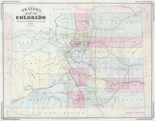
Denver Public Library's Western History/Genealogy Department is pleased to announce the addition of a new group of high-resolution, downloadable Denver maps to our Digital Collection.
This addition to the WH/G Digital Collection is an important step forward and goes a long way toward meeting our goal of making all the materials in our department as accessible to the public as possible.
Even better, the map collection, which focuses primarily on historic maps of Denver, is available via our Digital Collections Page and is free to DPL site users, no matter where they reside. If you're interested in taking advantage of this new resource, here are a few things you'll want to know.
Downloading the Maps
To download a map, just head over to our Digital Collections Page. Once you're there, click on the graphic that's labeled, Collections A-Z.
Once you're on the Collections A-Z page, scroll down the M section where you'll see two options for maps, Maps and Maps - High Resolution. Select the Maps - High Resolution option and you'll be taken to a list of downloadable maps.
After you've decided which map to download, click on the title link. Now you'll want to scroll to the bottom of the page and look for the link in the Archival File field. This link, not the Download link at the top of the page, is where you'll actually do the downloading. Once you've navigated to this field, you're just a click away from downloading a high-quality, high-resolution, historic Colorado map for your research.
Why Go Digital?
Here at WH/G we're tasked with two missions that don't always overlap. Our primary goal, of course, is to make the materials in our collection accessible to the general public. We're also responsible for preserving and maintaining some very rare, and very fragile, items such as our map collection.
Unfortunately, some of the items in our collection are too fragile to be handled on a regular basis. Even the items that don't seem fragile or scarce today will likely fall into those categories sometime in the future, and it's our responsibility to make sure they don't get used so much today that they're not in good enough shape for future generations to use.
Digitization of materials of this sort is a win/win because it makes the materials more accessible to researchers, and also allows us to safely store the originals in a climate-controlled environment.
Finally
We're extremely happy to be able to present this map collection to our customers and welcome any feedback from the folks who are actually using it in the field. If you have any questions or comments about this new digital collection, please email us at history@denverlibrary.org.


Comments
This is AWESOME! Thanks so
This is AWESOME! Thanks so much.
As an aside, please know that
As an aside, please know that while the files are free to download, the DPL-WH/G Imaging Services Lab has the capability to produce printed full-scale reproductions that look great on the wall!
Add new comment