Exhibit: December 8, 2008 - February 28, 2009 at the Central Library
Maps As Art asked you to look - and then to look again. Look not at the place or time represented but for how maps work as visual artifacts. Consider how cartographers and illustrators choose to represent the world with the elements of visual art, including line, space, perspective, color and imagery. Maps As Art presented more than 80 maps and afforded an opportunity to explore how we portray our world. Included were a map that shows the elevations of a lake, a city captured on cocktail napkin, and the iconic imagery of highway and street maps.
Hover over the map to scroll up and down.
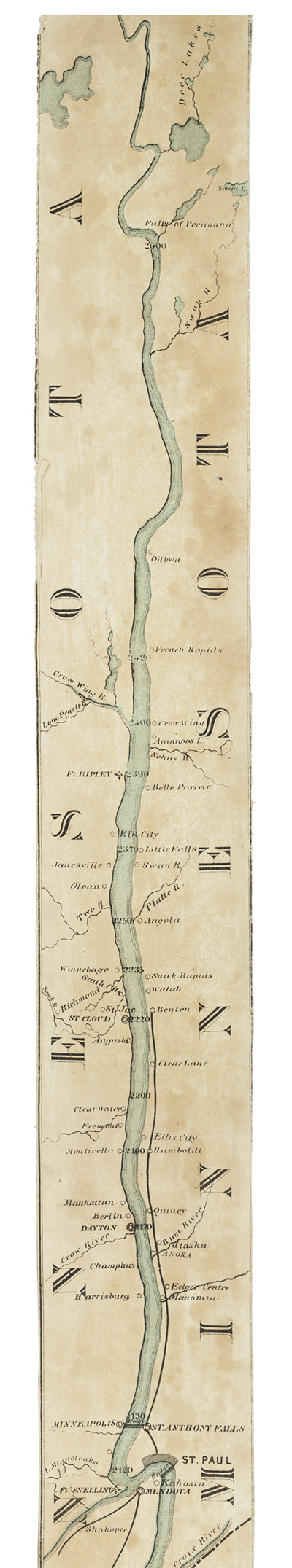
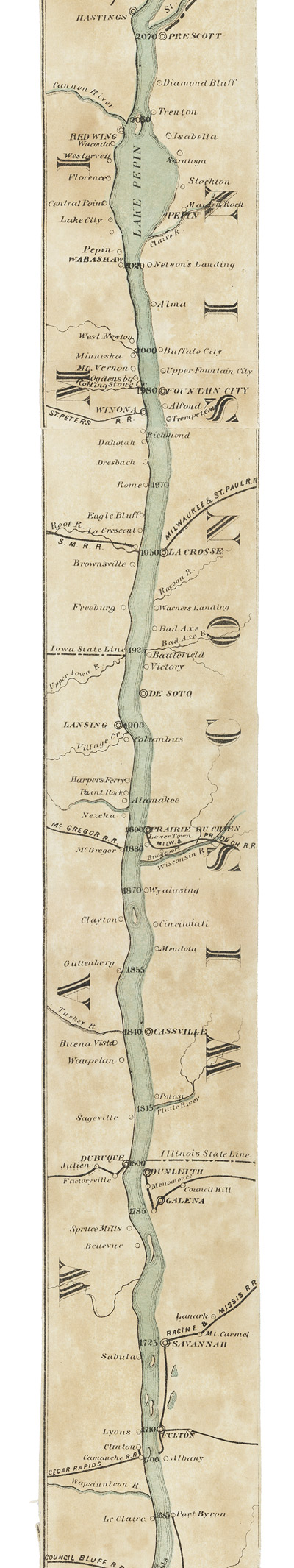
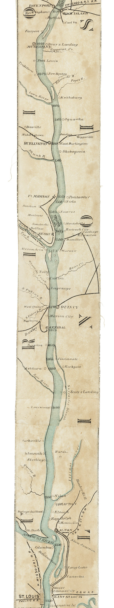
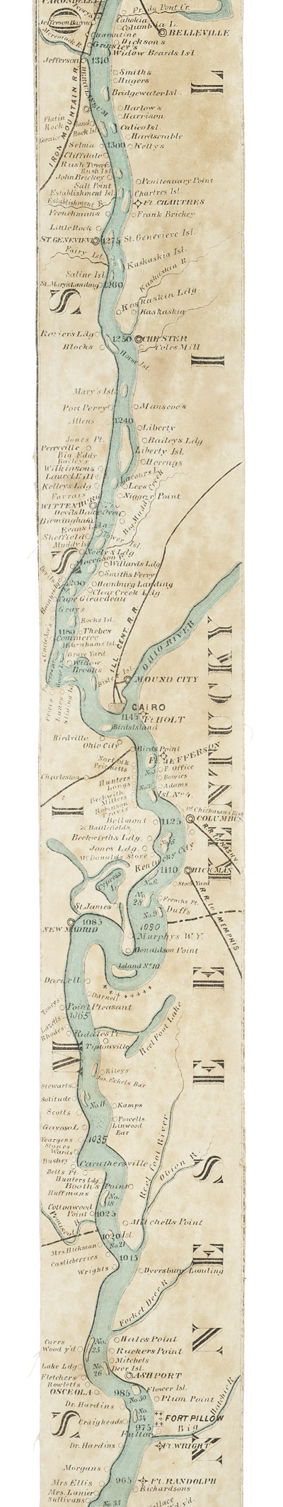
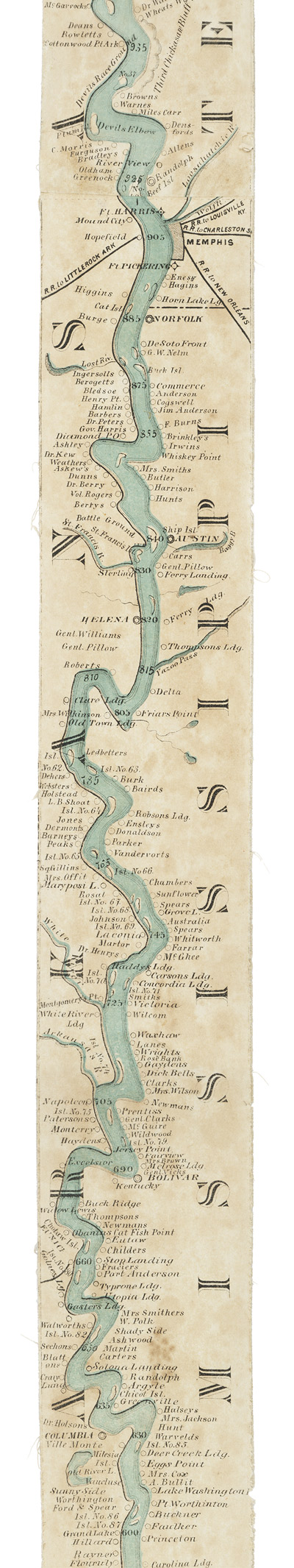
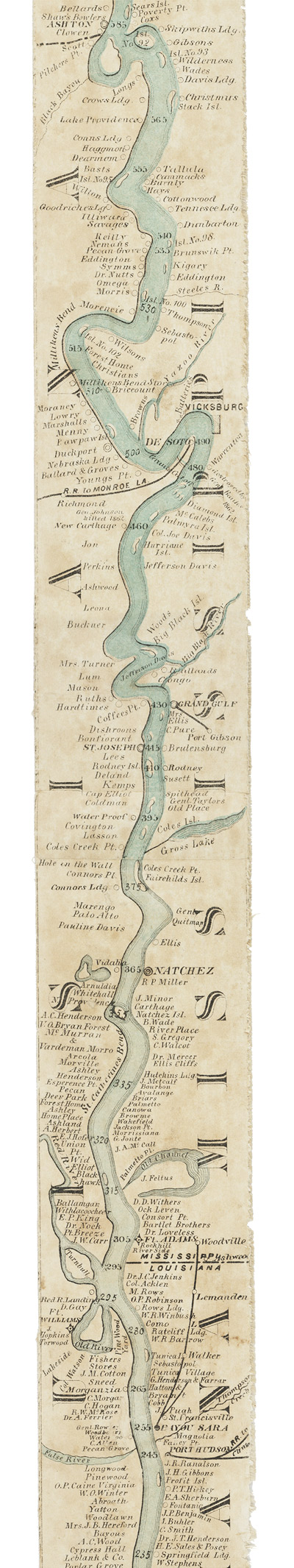
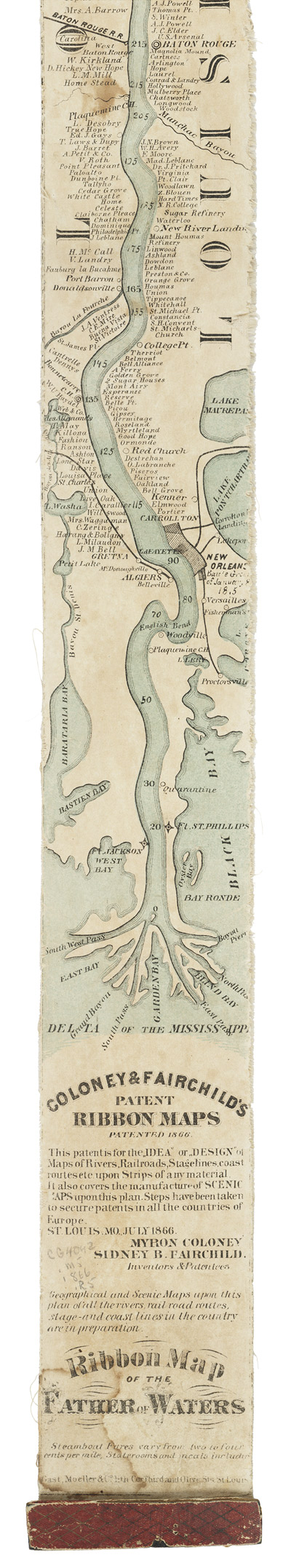
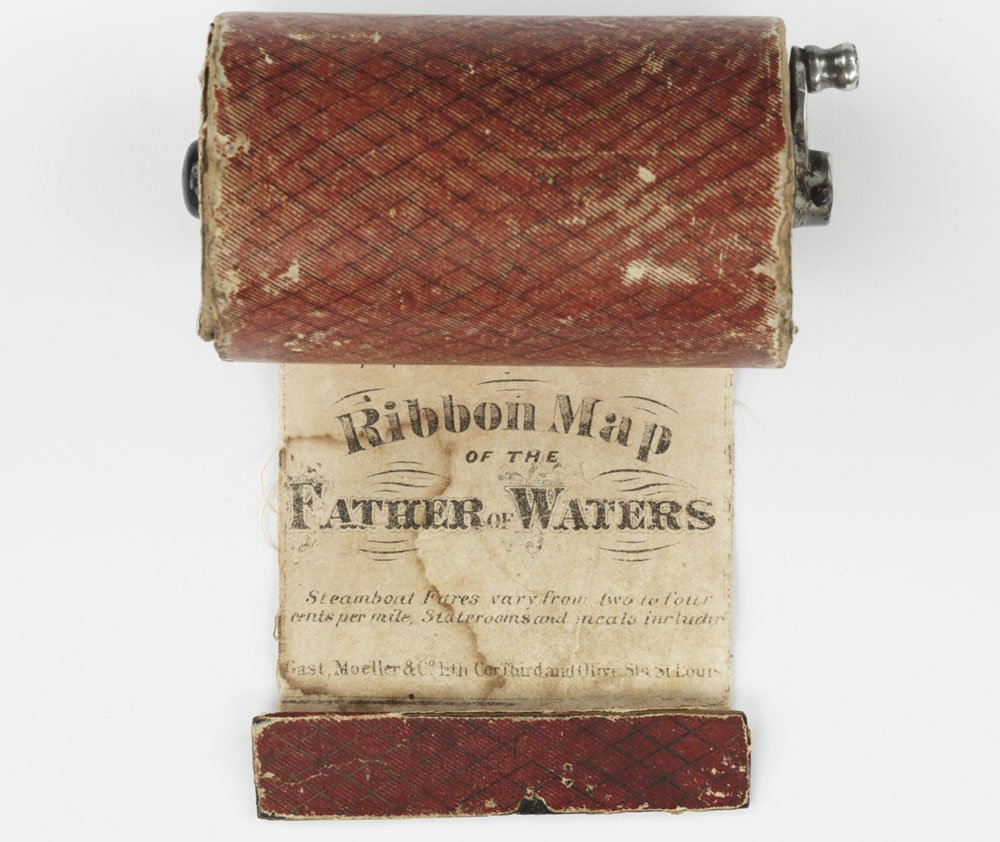
Myron Coloney and Sidney B. Fairchild. Ribbon map of the Father of Waters. St. Louis, Mo.: Moeller, 1866.
Original Map: 336 x 7 cm.
Denver Public Library, Special Collections and Archives, STX V CG4042 .M5 1866 .R5 (Map Box)
At ten feet in length and just less than three inches in width, the 1866 Colony and Fairchild ribbon map of the Mississippi River is one of the most unusual items in the Special Collections and Archives Map Collection. The map is pulled from a cylinder case and returned with the use of a small metal crank. The ribbon format is intended for use while traveling along the river, but the lack of a take-up reel makes examination of longer lengths awkward. Ribbon and roll maps and charts were later used for early aviation, and continue to be used for long-distance, off-road motorcycle races.
The Colony and Fairchild ribbon map is highly detailed and includes mile markers, ports and river towns. States are denoted along the sides of the map's length.
Notable locations include:
- St. Anthony Falls, Minnesota: mile 2130
- Confluence of the Missouri and Mississippi rivers above St. Louis, Missouri: mile 1350
- Confluence of the Mississippi and Ohio rivers at Cairo, Illinois: mile 1145
- Numerous plantations and landings below Memphis, Tennessee: mile 905
- Plantation of Jefferson Davis, president of the Confederate States of America: approximately mile 460
Hover over map to zoom in on details
![]()
Click to change map view (*See note regarding map sequence):
Map 1
Map 2
Map 6
Map 4
Map 5
Map 3
Map 7
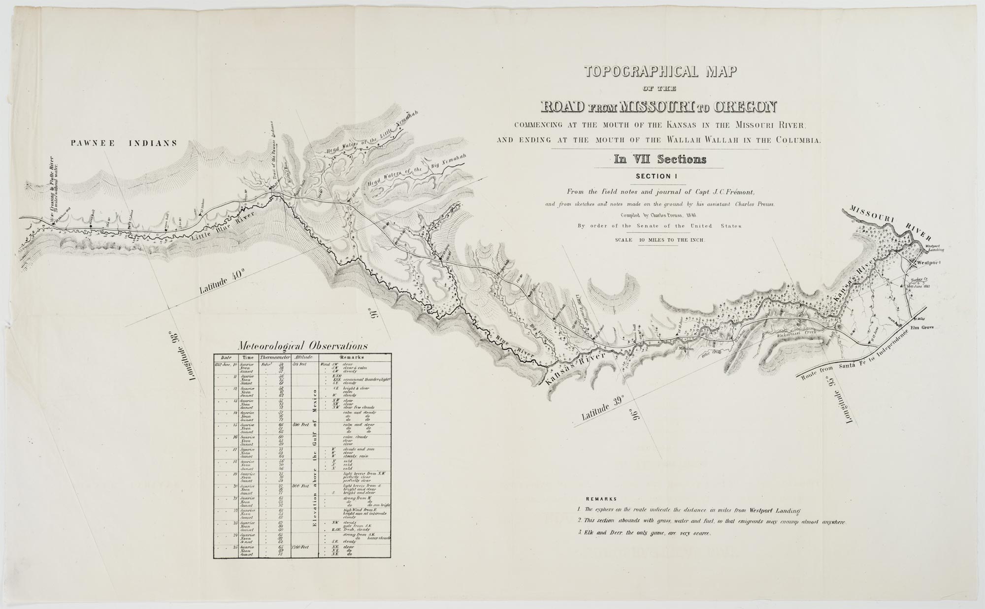
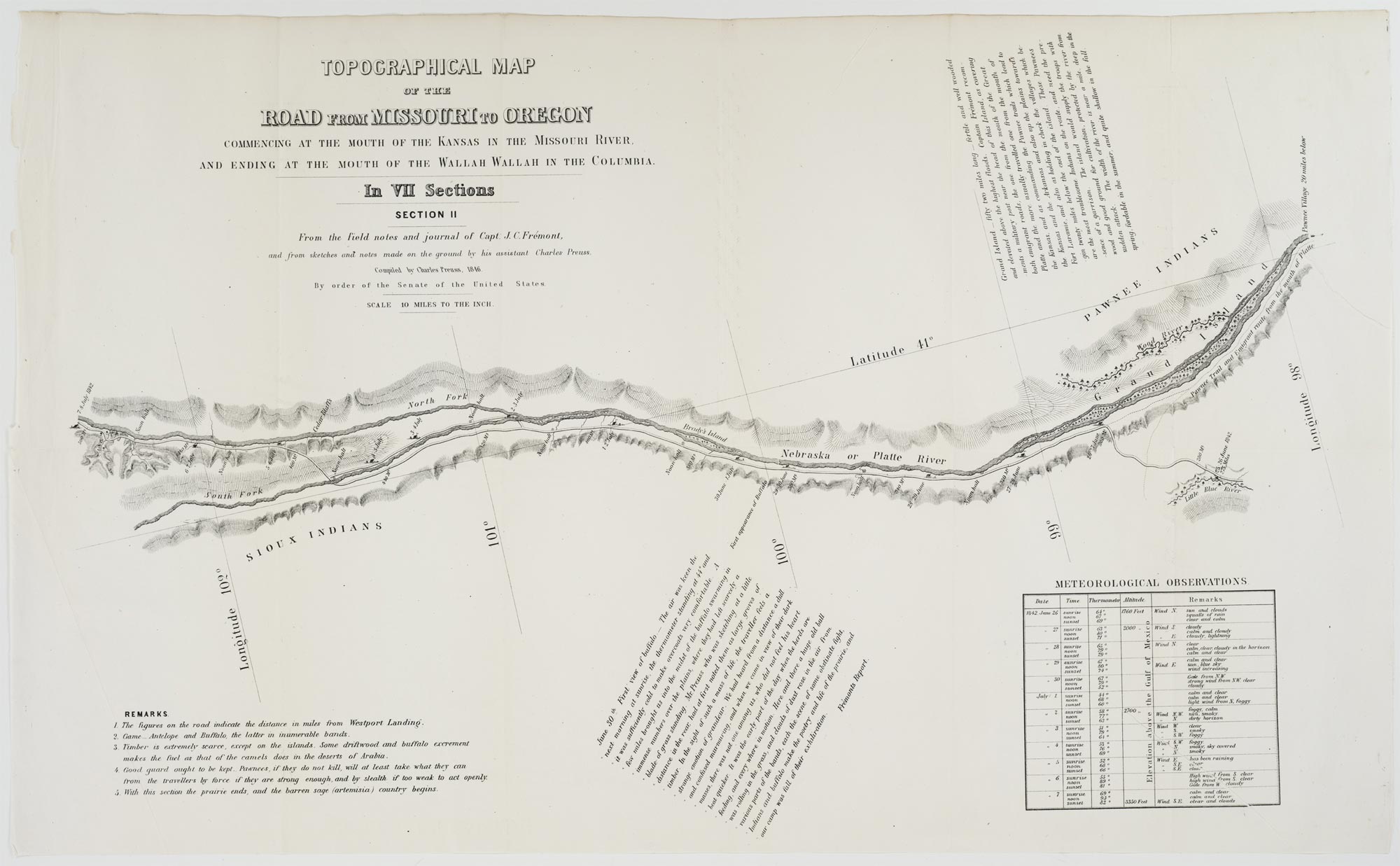
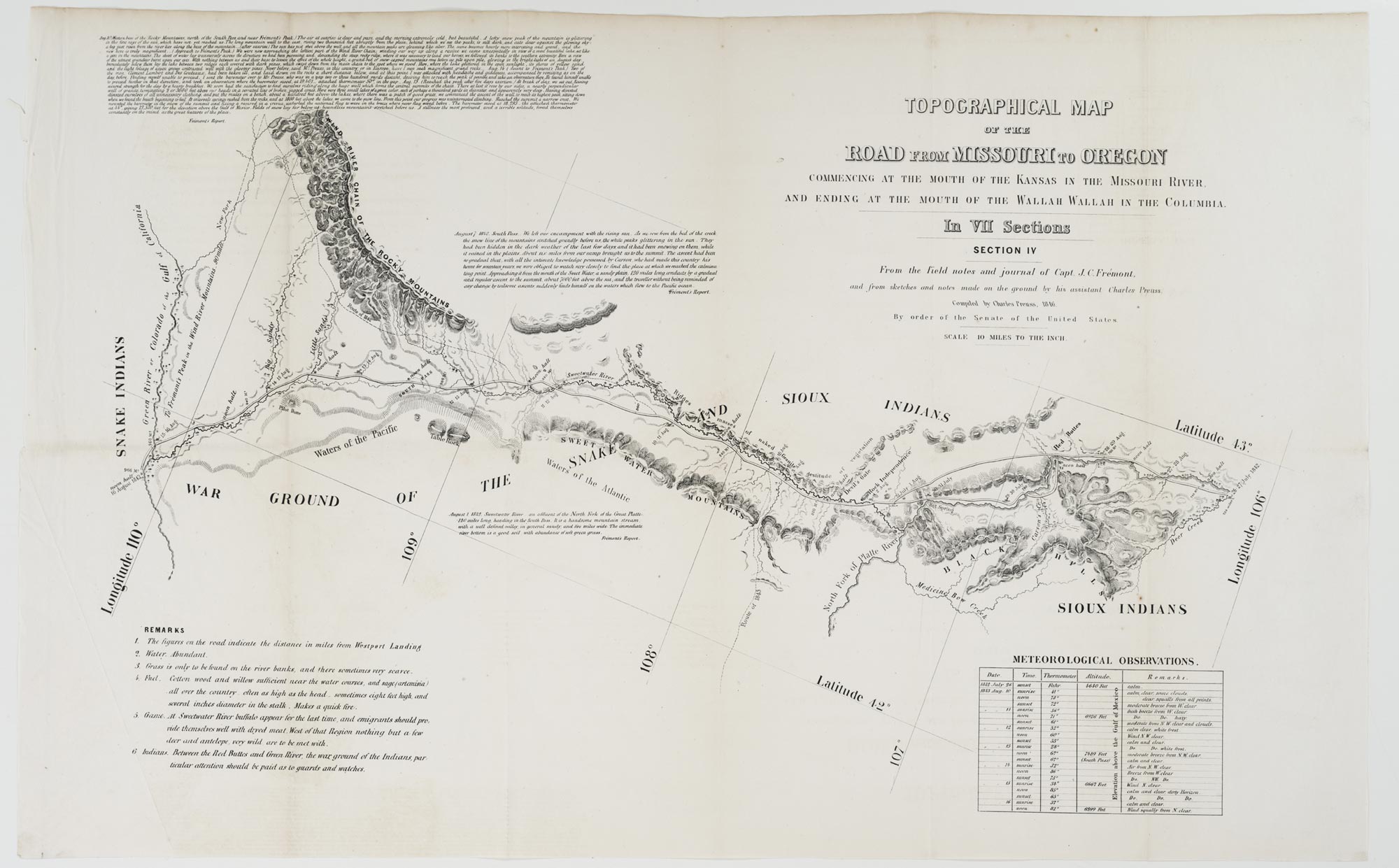
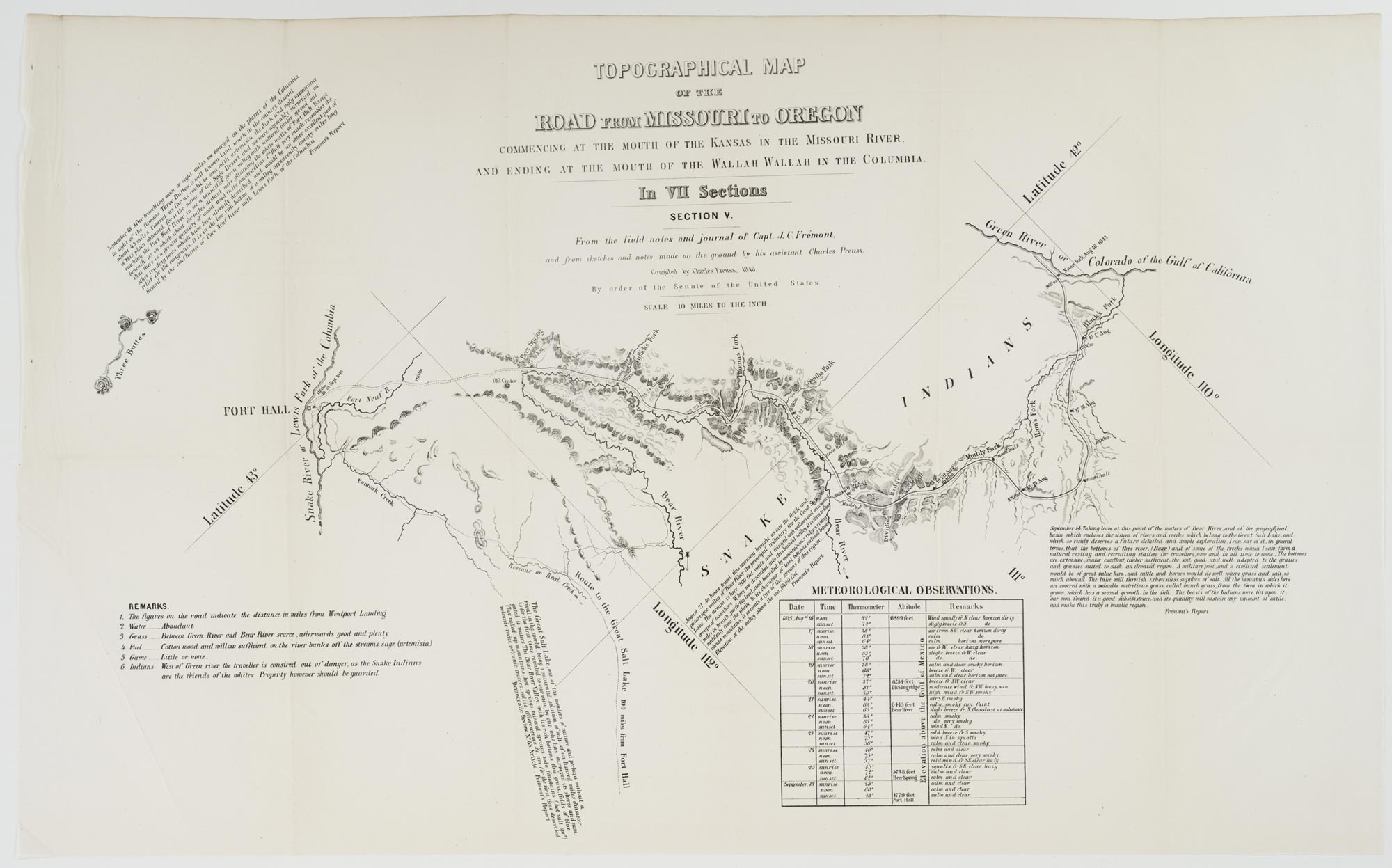
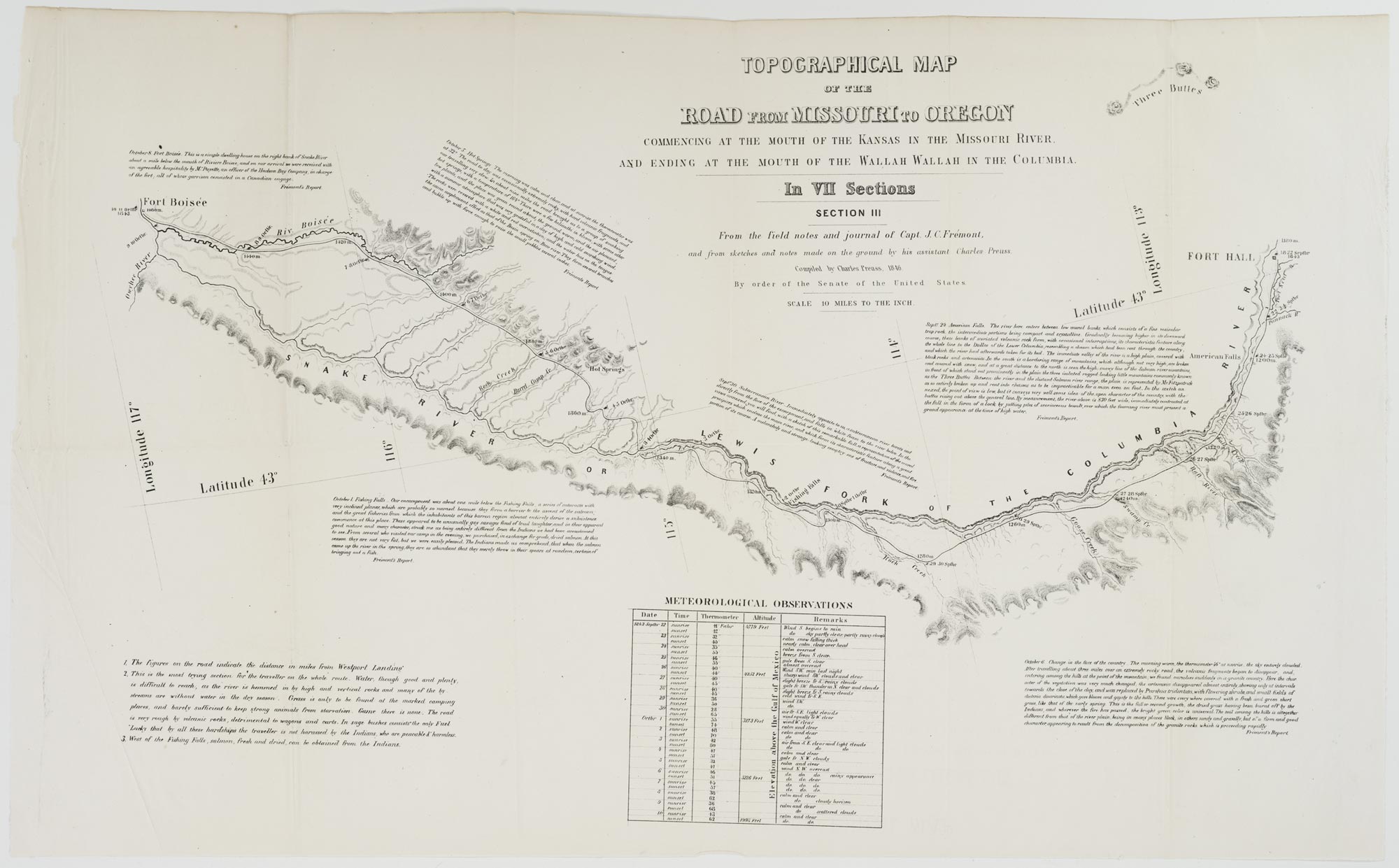
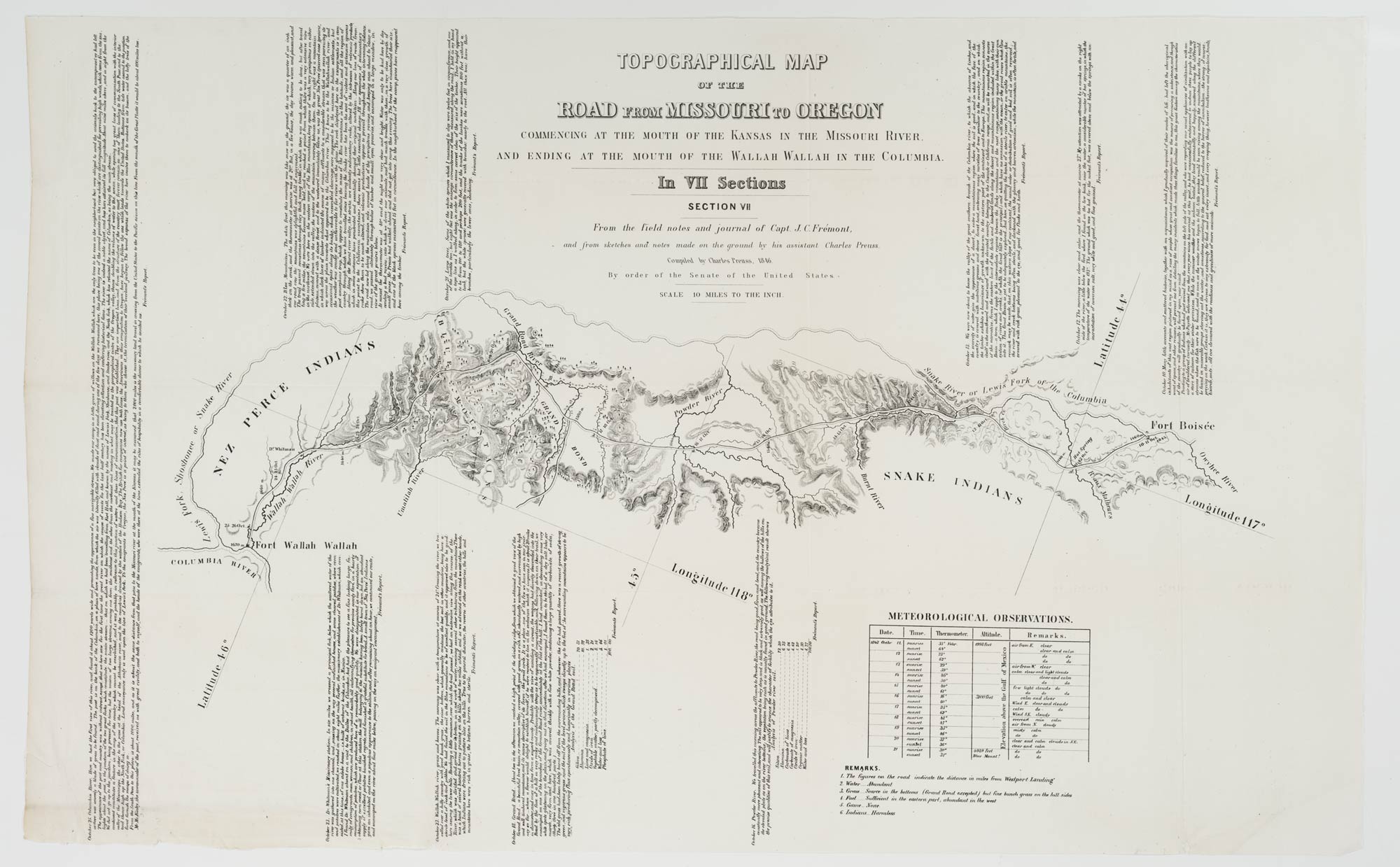
Charles Preuss. Topographical map of the road from Missouri to Oregon: commencing at the mouth of the Kansas in the Missouri River and ending at the mouth of the Walla Walla… compiled by Charles Preuss, 1846 by order of the Senate of the United States.
Original map on 7 sheets: sheets 41 x 66 cm. or smaller.
Denver Public Library, Special Collections and Archives, STX V CG4051 .P25 1846 .P73 (sections 1-7)
In 1846, Charles Preuss produced one of the most extraordinary maps of the nineteenth-century American West. Born in Honscheid, Germany, in 1803, Georg Carl Ludwig Preuss arrived in the United States in 1834. He accompanied Captain John Charles Fremont on his first, second, and fourth expeditions, and created this seven-section 1846 map while the explorer was busy with his third expedition to the West. The map moves East-to-West from present Westport, Kansas, to the junction of the Walla Walla and Columbia rivers. At a scale of ten miles to the inch, each section spans approximately 250 miles, and its copious annotation and tables would provide a wealth of information on the conditions immigrants to Oregon would find in the course of their travels.
Author and satirist Sarah Vowell presented Preuss' melancholy account of his time in the West as Act Three of an episode of Chicago Public Radio's This American Life aired first in 2007 and re-broadcast in 2008. Preuss was given voice by the actor, Dermot Mulroney, who read from sections of the cartographer's diary. Charles Preuss took his own life in 1854.
*The instance of the 1846 Preuss map reproduced here was printed in House Report 145, 30th Congress, 2nd session (1849), and two of its sections (3 and 6) are juxtaposed. The correct sequence using the printed section numbers is 1,2,6,4,5,3 and 7.
Take a video tour of the Maps as Art exhibit with Senior Special Collection Librarian Wendel Cox.
Go behind the scenes and find out what it takes to build a library exhibit.